ISRO’s latest report sheds light onto expanding glacial lakes in Himalayan region
At least 89 per cent of the 2,431 Himalayan glacial lakes identified in 2016-17 have expanded significantly since 1984, the Indian Space Research Organization (ISRO) said in a report.
Experts say the results of ISRO’s analysis are worrying because the expansion of glacial lakes due to warming could have widespread consequences in downstream areas. ISRO said satellite data collection over the last three to four decades provides valuable feed on changes in the glaciated environment.


ISRO said in the report that long-term satellite imagery covering the catchments of Indian Himalayan river basins from 1984 to 2023 indicates significant changes in glacial lakes. The ISRO report said 601 glacial lakes, or 89 per cent, have expanded more than double, and 10 lakes have expanded between 1.5 times and up to double their size. Sixty-five lakes have expanded 1.5 times.
Of the 2,431 glacial lakes larger than 10 hectares, 676 have expanded significantly, and at least 130 of these lakes are in India – 65 (Indus River Basin), 7 (Ganga River Basin), and 58 (Brahmaputra River Basin). . ISRO, in its report ‘Satellite Insights: Expanding Glacial Lakes in the Indian Himalaya’ released on Monday, said altitude-based analysis shows that 314 lakes are located in the 4,000 to 5,000 meter range, and 296 lakes are above 5,000 meters altitude. Are.
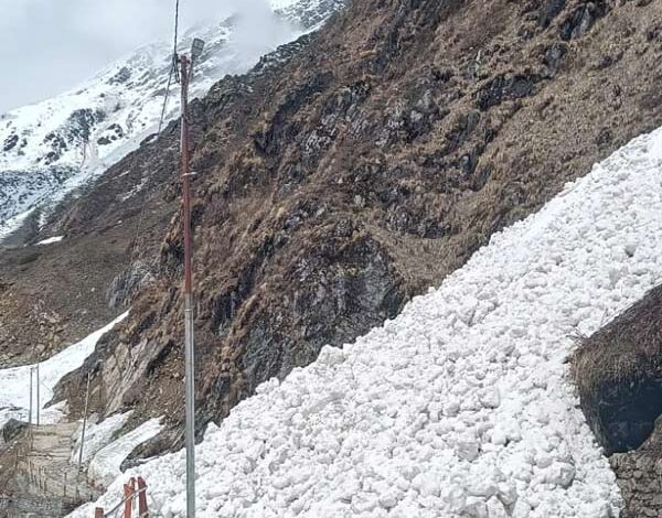
ISRO said long-term changes in the Ghepang Ghat glacial lake (Indus River Basin), located at an altitude of 4,068 meters in Himachal Pradesh, lead to a 178 per cent increase in size between 1989 and 2022 from 36.49 to 101.30 hectares. The rate of growth is approximately 1.96 hectares per year.
ISRO said satellite-derived long-term change analyzes also provide valuable insights to understand glacial lake dynamics, which can be useful for assessing environmental impacts and for glacial lake outburst flood (GLOF) risk management and climate change adaptation in glacial environments. Are necessary to develop strategy.
ISRO said that the study faced challenges due to the inaccessible and rugged terrain. The space agency said satellite remote sensing technology, however, serves as an excellent tool for inventory and monitoring due to its wide coverage and revisitability.
The Himalayan mountains are often called the ‘Third Pole’ because of their extensive glaciers and snow cover, and they are highly sensitive to changes in global climate, both in terms of their physical characteristics and their social impacts. ISRO said in the report that research conducted around the world has consistently shown that glaciers around the world are experiencing unprecedented rates of retreat and thinning since the beginning of the Industrial Revolution in the 18th century.
This retreat leads to the formation of new lakes in the Himalayan region and expansion of existing lakes. These bodies of water formed by the melting of glaciers are known as glacial lakes and play an important role as a source of fresh water for rivers in the Himalayan region.
However, they also pose significant risks, such as GLOFs, which can have devastating consequences for downstream communities. GLOFs occur when glacial lakes release large amounts of meltwater due to the failure of natural dams, such as moraines or dams made of ice, resulting in sudden and severe flooding. These dam failures can be caused by a variety of factors, including snow or rock avalanches, extreme weather events, and other environmental factors.