Typhoon Hinnamnor: Strongest storm of 2022 brews in Western Pacific
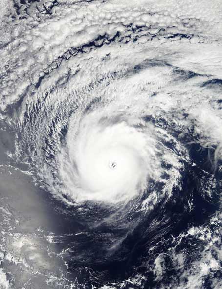
Another big weather trouble has been sounded for Japan and China, already troubled by drought and heatwave. Indeed, the concerns of these two countries have been increased by the strongest global storm of 2022, which could endanger the southern islands of Japan across the East China Sea. According to the US Joint Typhoon Warning Center, Super Typhoon Hinnamnor is currently moving at about 160 miles (257 kph) per hour. Its maximum speed has been recorded at 195 mph. Because of this, the height of the wave has been recorded up to a maximum of 50 feet (15 m).
Estimated to move to Ryukyu Island now
According to an official of the Japan Meteorological Agency, Hinnamnor will be the strongest storm of 2022 on the basis of the speed of this storm that has been recorded so far. The Hong Kong Observatory said the storm was centered about 230 kilometers east of Okinawa, Japan, at 10 a.m. and is forecast to move west-southwest toward Ryukyu Island at about 22 kilometers per hour.


However, the US JTWC has predicted that the super typhoon will lose some of its strength in the coming days. Phil Klotzbach, lead author of Colorado State University’s seasonal storm forecast, said that we keep ocean records in detail. Only twice in more than seven decades has there been a hurricane in August. The first storm was in 1961 and the second in 1997, but both of them did not have the same speed as the storm of this time.